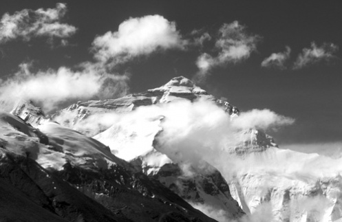
Image 1 - This picture was taken from an altitude of about 19,000 feet above sea level looking south towards the summit of Mount Everest from close to Advanced Base Camp in Tibet. The highest point on Earth towers majestically above the Rongbuk Glacier, which marks the approach route followed by early mountaineers heading towards their summit attempts. A rough four-day journey across the Tibetan Plateau must be undertaken to reach the bottom of the valley some twenty-five miles north of this location. It is then an arduous and challenging high-altitude trek, sometimes over huge boulders, to reach the Rongbuk monastery. Only then can one begin the the climb to Base Camp (2½ hours), Advanced Base Camp (another 6 hours) and, under ideal conditions with crampons and an ice-axe, on to Camp One. Any further progress is the preserve of serious mountaineers.
The key to getting the photograph, apart from the journey across Tibet, was the weather. The summit of Everest is rarely clear of cloud, and was completely hidden from view when I arrived at the foot of the glacier two days earlier. Camping at such high altitudes is also hard work because the lack of oxygen makes sleep difficult and night-time temperatures are dangerously low (-20oC). Nevertheless the long wait was rewarded in the middle of the second day when the cloud gradually cleared. This photograph was taken very simply using just a tripod, an ultraviolet filter and a lot of patience. The cloud formation was the best available during the three hours I waited at this particular location. An hour later the mountain had once again vanished, although it did reappear at sunset and during the following night.


