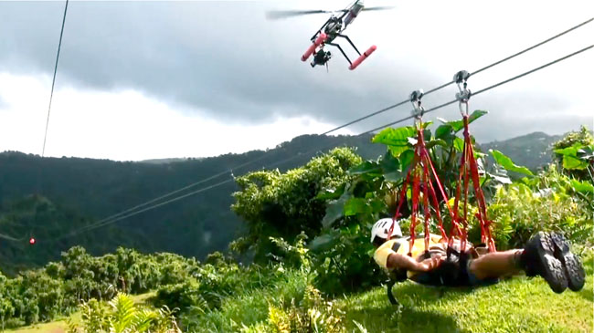
The aerial image below shows an R/C helicopter, equipped with a sophisticated camera mounted on a gyro-stabilized gimbal which is also remotely controlled. The camera lens also has its own image stabilization. In this instance, the helicopter is following a zip-wire rider travelling across a valley in the El Yunque rainforest. The work was undertaken by HeliVideo for a Puerto Rican tourism commercial.
Bolivia's North Yungas road, also known as El Camino de la Muerte (The Road of Death), is a 43 mile single-track route leading from La Paz, the country's capital city, to Coroico located 35 miles northeast of La Paz in the Yungas region. A second route known as Chulumani Road connects La Paz to Chulumani, located 40 miles to the east, is considered to be almost as dangerous.
The road is a muddy single track with no guard rails and precipitous drops at its outer edge. It has many hairpin bends. Loose rocks fall from the steep mountainsides above the road and visibility is restricted by rain, fog and cloud formation. The drivers of vehicles heading downhill are obliged to give way to vehicles travelling in the opposite direction and must pass on the outer side of the road. The width of the road is such that passing is possible only in certain places, and with the wheels of the unfortunate outer-side vehicle positioned just a few inches from the crumbling edge of a 2,000-foot precipice.
The Yungas road sees an average of one accident every two weeks, resulting 200 - 300 deaths per year. On 24 July 1983 a bus veered off the road into a canyon, killing more than 100 passengers. This tragic incident was probably Bolivia's worst road accident.
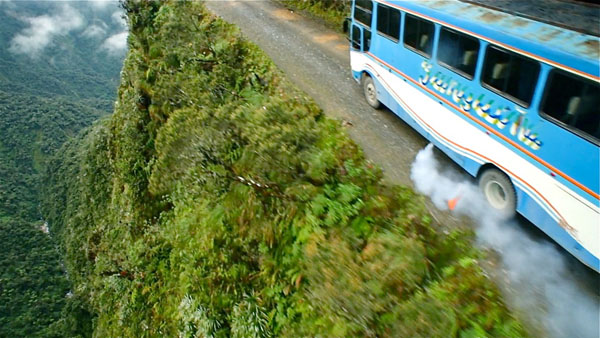
The image below was taken from an R/C helicopter during filming of The Road of Death for the Discovery Channel's documentary series Hell Roads.
Images by kind permission of Eric Austin - www..helivideo.com


